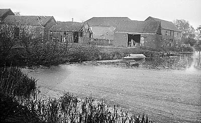
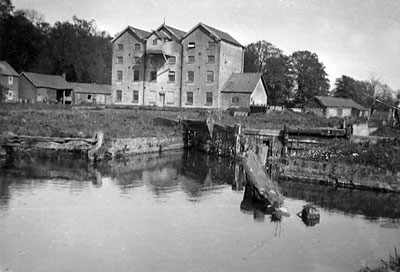
Aylsham
staithe 1928
|
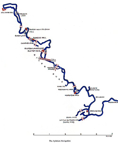
Aylsham Navigation
River Bure |
Aylsham |
Over the centuries the whole area was moulded and developed with Millgate becoming a hub of industrial activity once the 11 mile long Aylsham Navigation was opened on completion of the new canal basin excavated alongside the mill in October 1779. A channel was cut to the north of the mill and a staithe with warehousing was built to house the goods transported in and out by wherry. By 1854 wherries plied weekly between Aylsham and Yarmouth. At the height of the water transport years 26 wherries were serving Aylsham. In 1880 the railway arrived. Aylsham North's M&GN station a few hundred yards away took over some of the traffic when it opened, as did the GER's Aylsham South station. Nearby pubs and inns such as The Anchor thrived for many generations. |
|
|
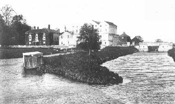
Aylsham
staithe 1928
|
|
The Aylsham Navigation |
|
| 1773: Navigation
authorised by an Act of Parliament 1774: Work started 1779: Navigation opened, running for 9½ miles with 5 locks, one at each of the mills
26th August 1912: The great flood effectively closed the Naviagation by destroying the locks 1974: Aylsham Canal Basin filled in |
Aylsham Navigation |
The Commissioners of the Aylsham Navigation are desired to meet at
the Black Boys in Aylsham, on Tuesday the 16th of September next, at
Ten o'Clock in the Forenoon, to audit and settle the Treasurer's Accounts,
when Interest on the Loans will be paid the respective Proprietors. And
Notice is hereby given, that the Commissioners of the said Navigation
will meet at the Black Boys Aylsham on the first Tuesday in every month
after September next, at Ten o'Clock in the Forenoon, until the General
annual Meeting to be held in August 1784. [signed] John ADEY, Clerk to the Navigation. Aylsham, Aug. 28, 1783. Norfolk Chronicle - 30th August 1783 |
 |
|
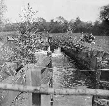
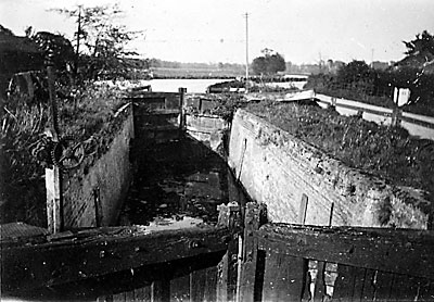
Aylsham
lock 1928
|
 |
 |
|
Burgh lock 1927
|
Burgh
lock 2003 |
 |
|
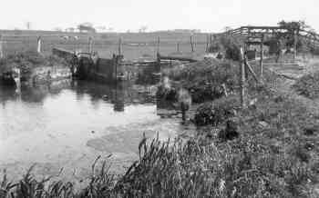
Oxnead
lock after the flood in 1912
|
 |
 |
|
Buxton lock c.1910
|
Buxton
lock 1928 |
 |
 |
|
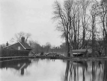
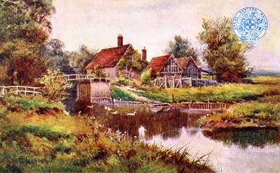
Coltishall
lock 1905
|
Great
Eastern Railway postcard of Coltishall Lock c.1907 |
 |
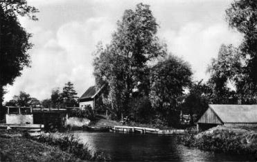 |
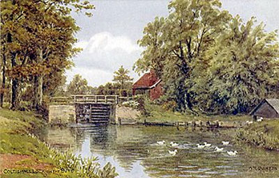
Coltishall lock c.1910 - painting on postcard by A. R. Quinton |
Coltishall lock c.1910 |
|
CYRIL ("SAM") SPINKS - Aylsham
Mill worker for 55 years interviewed by Lynette Rust and LR - Sam, can you remember starting at the mill? |
Project to mark 100 years since closure of Aylsham Navigation route receives funding
|
Funds have been made available to help uncover the history behind one of Norfolk's working waterways from days gone by. |
 |
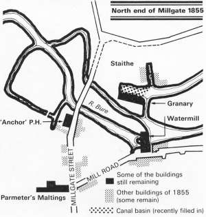 |
1855
layout of Aylsham staithe |
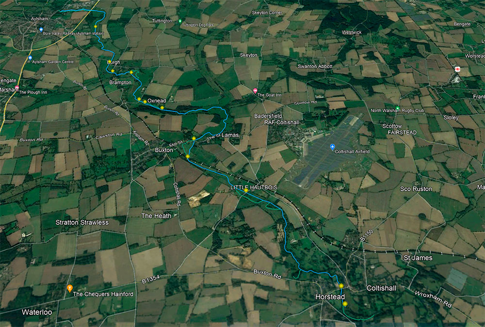 |
Google Earth view of the Aylsham Navigation route created by Gary Newland - 2024 |
If
you have any memories, anecdotes or photos please let us know and we may
be able to use them to update the site. By all means telephone 07836 675369
or
|
Copyright © Jonathan Neville 2024 |