 |
|
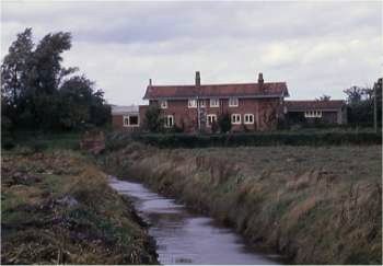
The
mill house October 1967
|
|
Antingham Bone Mill - Upper
River Ant / North Walsham & Dilham Canal |
 |
|
The
mill house October 1967
|
|
Antingham unsually
had two watermills within a half a mile of each other - |
 |
|
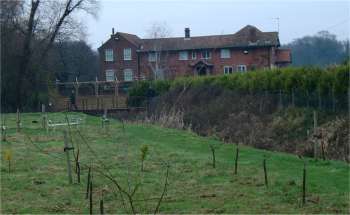
The
mill house January 2003
|
|
The upper and
smaller mill was built at the canal end of Antingham Pond. The mill was
quite small and was joined to the mill house - Plot 231, Bone Mills & Yard - area 30 perches. The mill was connected to the
main canal by a short waterway allowing a small fleet of boats to be used
to transport goods between the two mills until the channel was filled
in c.1905. |
|
Bones from local butchers and slaughterhouses were crushed along with phosphates from ocean islands that arrived in the form of ships' ballast, which was then transported by rail to North Walsham station or by wherry up the canal. The resulting fertilizing compounds were then sold to Fisons. A staithe was built nearby as the canal terminated here in a basin 80 feet wide and 150 feet long. This section of the canal remained navigable until 1893 when Swafield staithe became the terminus. The mills ceased operation in the early 1920s and the buildings were demolished after the second world war. |
 |
 |
|
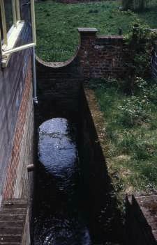
Brickwork remains May 1968
|
Old watercourse May 1968 |
 |
|
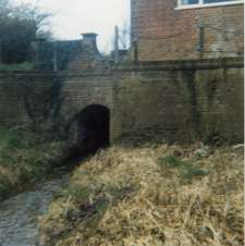
Tailrace
March 1977
|
|
Contents of the Upper Mill as listed in Schedule 1 of the 1847 Lease Agreement |
| Water and pit wheels Floodgates Two nut wheels One pair of cutters with machinery in wooden frames and screens Sack tackle |
|
Indemnity and insurance at Norwich Union. |
|
The 1847 Lease mentions the right to burn bricks on the land forming Bradfield Hall Farm on Plot No. 2 on the Map of Indenture. |
|
The North Walsham & Dilham Canal |
| This was the
only official canal in Norfolk and was really the canalisation of the River
Ant. It was made wider than most other canals in order to accommodate Norfolk
wherries. The main cargoes were offal to the two Antingham Bone mills with
return loads of fertiliser. Corn and flour moved in and out of Bacton
Wood and Swafield mills with other commodities
such as timber, farm produce and coal making up the majority of the remainder
of trade. It was hoped that coal would be the mainstay cargo but this never
materialised. The canal was just over 8¾ miles long, ran from Smallburgh
to Antingham and contained 6 locks: Honing, Briggate
mill, Ebridge mill, Bacton
Wood mill, Swafield lower and Swafield
Upper. 1812: Act of Parliament passed authorising construction of the canal July 1826: Canal opened having cost £32,000 to build 1885: Ailing canal sold for £600 but the company's London solicitor absconded with the money 1886: Scheme introduced to encourage tourist traffic c.1893: Antingham - Swafield section abandoned because of lack of traffic 1934: The wherry Ella, sailed from Bacton Wood Staithe for the last time 2003: Canal navigable for the first 2 miles as far as Honing Lock |
 |
 |
|
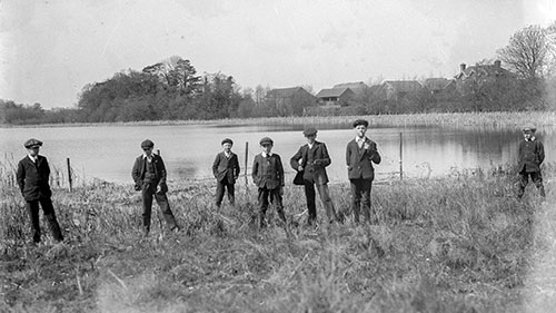
Antingham Lake - 19th April 1914
|
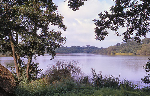
Antingham Lake - September 1967 |
|
Men were busy in the mills from January until the end of May, sometimes working until midnight. They then maintained the mill and went on to work on local farms. |
 |
 |
|
Antingham
Lower site in foreground and Antingham Upper
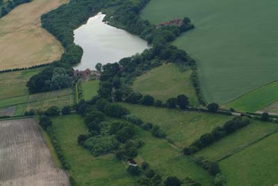
at the foot of the pond 30th June 2004 |
Antingham
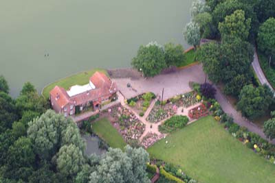
Upper 30th June 2004 |
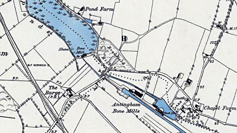 |
O. S. Map 1885 |
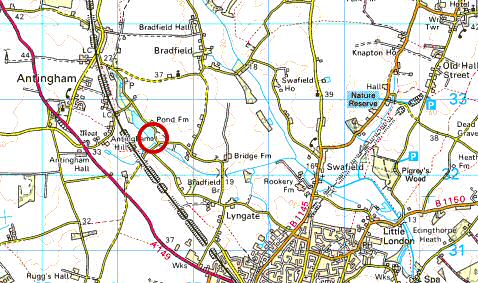 |
O.S. Map 2005 Image reproduced under licence from Ordnance Survey |
|
1257: Chamberlain of St. Benet's Abbey held Antingham with a Mill
Kelly's 1892: Mrs Charlotte Horsfield, bone crusher Kelly's 1896: Edward Darby Horsfield, farmer, bone crusher and artificial manure manufacturer
Kelly's 1922: Edward Darby Horsfield, bone crusher |
If you have any memories, anecdotes or photos please let us know and we may be able to use them to update the site. By all means telephone 07836 675369 or
|
| Nat Grid Ref TG 26433246 | Copyright © Jonathan Neville 2004 |