| Gt. Yarmouth Quay
postmill |
 |
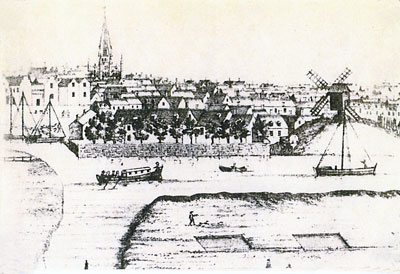
J. Corbridge's West Prospect of Yarmouth - c.1740 |
Gt Yarmouth Quay mill was an open trestle postmill that stood on a large mound on the east bank of the River Yare.
|
One of the first erections on the North Quay was a post windmill, which in 1579 one Christopher Short was allowed to build on 'a plot of ground' there. |
NORFOLK |
To be SOLD by AUCTION
On Saturday 15th Inst. at the Angel in Yarmouth A Good and well accustomed WINDMILL situated on the Key in Yarmouth and commonly known by the Name of the Key Mill. The Whole is in very good Repair and may be viewed any Time before the Sale. Norwich Mercury - 8th December 1764 |
To be SOLD
To the best Bidder at Vincent's Tavern in Great Yarmouth On Wednesday the 9th Day of February Inst. by Order of the Assignees under a Commission of Bankrupt lately awarded against Mr. Christopher Eaton. All the real ESTATE of the said Mr. Eaton situate in Yarmouth, viz. Lot IV. A Corn Windmill in good repair situate on the Key and commonly called the KEY Mill. Further Particulars may be had of Mr. William Palgrave, jun. one of the Assignees or of Mr. Spurgeon in Yarmouth. Norfolk Chronicle - 5th February 1774 |
Creditors of Christopher Eaton of Great Yarmouth, a Bankrupt . . . to meet on Monday 25th this Instant April
. . .
Norfolk Chronicle - 23rd April 1774 |
To be Let
PREMISES near the Quay Mill . . . Dwelling house . . . for a CURRIER & LEATHER SELLER . . . Norfolk Chronicle - 10th October 1795 |
ROW No. 34 from North Quay to George Street, called Quay Mill Row, because a post windmill, named the \Quay Mill formerly stood opposite to it upon the ground adjoining the river. |
 |
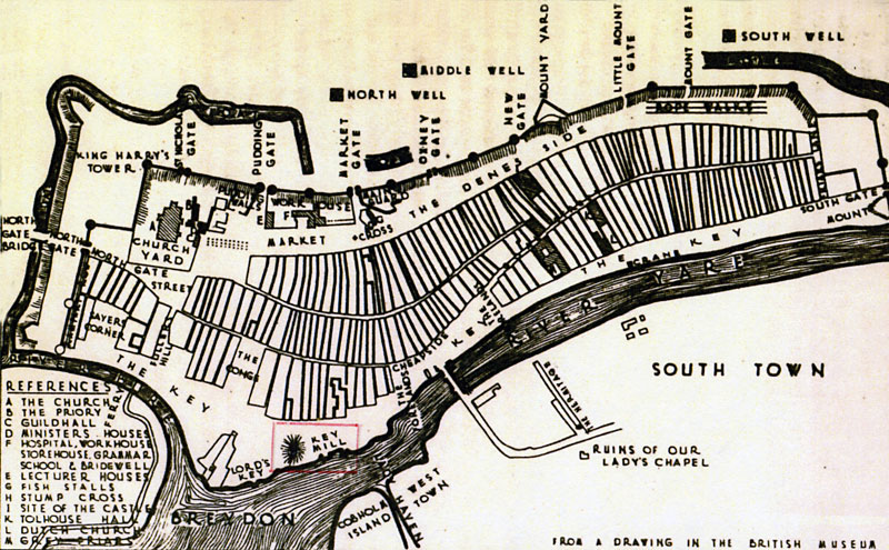
Plan of Yarmouth about 1619.
From a drawing in the British Museum, shows:- "Key Mill" against a mound The Rise of Yarmouth, A. W. & J. L. Ecclestone - 1959 |
Map of Yarmouth 1668 shows 4 mills on the Denes and Quay Mill
Notes on the map: The picture-map chosen to illustrate the medieval layout of Yarmouth is that published by Sir Robert Paston in 1668 to promote an ambitious but abortive scheme to develop his marshes at Little Yarmouth or Southtown on the opposite bank of the River Yare. It shares with Sir Bernard de Gomme's manuscript map of 1668 the distinction of being the earliest reasonably accurate survey of the town . . . The map is reproduced from an original in the Norfolk & Norwich Archaeological Society Library . . . King's Lynn & Great Yarmouth, Two Thirteenth Century Surveys - Elizabeth & Paul Rutledge Norfolk Archaeology Vol XXXVII - 1980 |
"View of Yarmouth as it appeared in 1775"
Shows: A tall smock mill north of bridge (later North Quay) A post mill on the Denes F. Blomfield, History of Norfolk |
 |
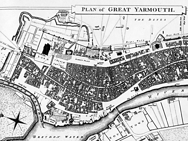
Faden's Map - 1797 |
 |
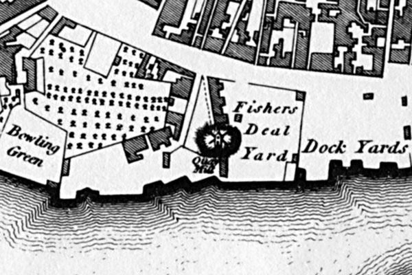
Closeup from Faden's Map - 1797 |
1579: Mill built by Christopher Short, miller |
If you have any memories, anecdotes or photos please let us know and we may be able to use them to update the site. By all means telephone 07836 675369 or
|
| Nat Grid Ref TG52020775 |
Copyright © Jonathan Neville 2014 |